Skip to content

LaGrange County

Two windmills from Lima and a traction engine from Sturgis

The 1920 history of this county remembers Isaac Lehmer in a single sentence, and the sentence sits inside another man's biography. It calls him the inventor of one of the first traction engines, and says nothing of when the engine was built, where, or under what patent. The windmill in the picture is not his.
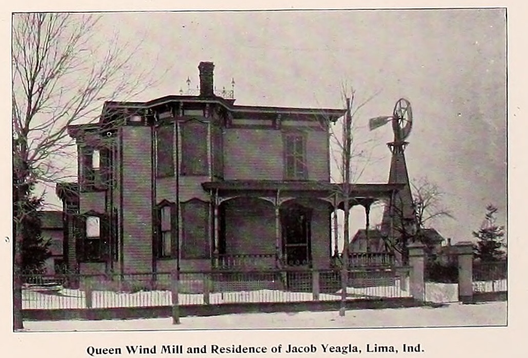
A photograph printed in an 1893 county atlas. A two storey house with a bay window, a deep porch and a brick chimney stands behind a picket fence, with bare trees at either side. To the right of the house a wooden tower rises to a bladed wheel and a tail vane. A printed line beneath the photograph reads Queen Wind Mill and Residence of Jacob Yeagla, Lima, Ind.

Detail from leaf 85, printed page 81, Illustrated Atlas and Columbian Souvenir of LaGrange County, Indiana, 1893, via the Internet Archive. Crop box 783, 1811 to 1813, 2511 on the 2599 by 2930 scan; shipped at the native size of the crop and not otherwise altered.
History

How this county was settled, named, and argued over, read out of two county histories and a stack of insurance maps.

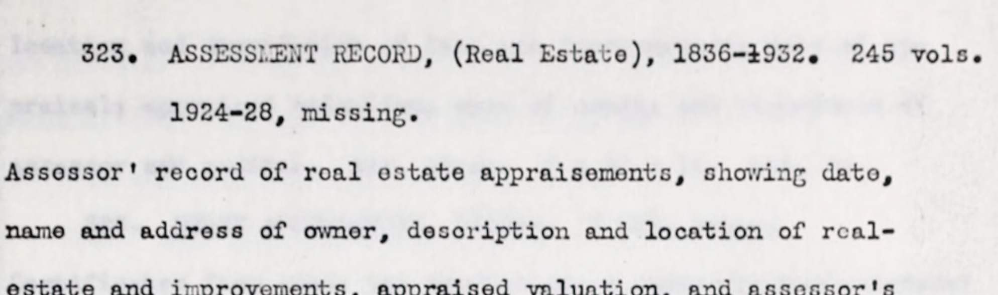
  • Two lines of typescript from a 1937 inventory, reading 323. ASSESSMENT RECORD, open bracket Real Estate, close bracket, 1836 to 1932, 245 volumes, and beneath it, indented, the words 1924 to 28, missing.

    LaGrange County

    No records could be found

    In 1937 a federal survey counted what this county had kept. It found the commissioners' minutes running unbroken from 1832, and three holes: two gaps in the tax books, and an office whose records could not be found at all.

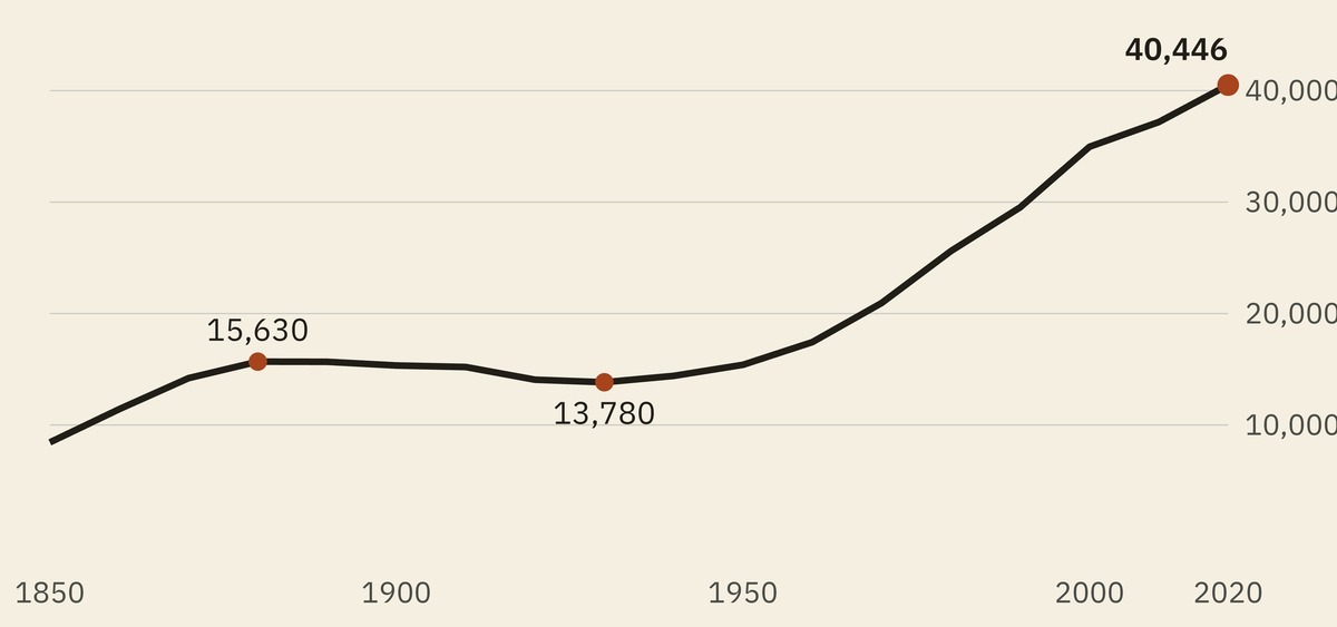
  • A line chart of the county's population at every census from 1850 to 2020. The line rises to a shoulder around 1880, runs almost level and then sags to its lowest point in 1930, and climbs steeply from the middle of the century to end at its highest point, marked 40,446.

    LaGrange County

    The county's smallest century

    Both of this county's histories were written while it was shrinking. The federal count says its nineteenth century was its smallest, and that every one of its eleven townships is larger now than it has ever been.

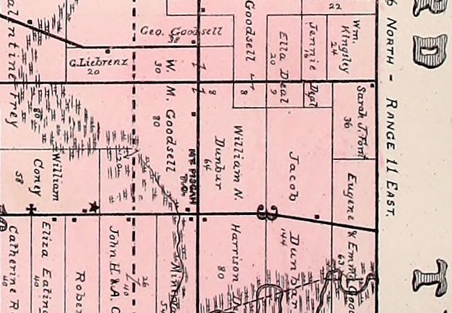
  • A detail from an 1893 township plat, printed in pink, showing a grid of farm parcels with each owner's name and acreage written across it. Along a road running north and south, set sideways in bold capitals, the words MT. PISGAH with P O beneath them. The names around it read W. M. Goodsell 80, William N. Dunbar 64, Geo. Goodsell 38, Jacob Dunbar 144 and Wm. Kingsley 24. A star marking a school stands a short distance to the west. No town lots or streets are drawn anywhere near the name.

    Milford Township

    The office the county history buried

    The 1882 county history mentions Mount Pisgah once, in another man's biography, as a post office that used to exist. The Post Office Department went on listing it for another twelve years.

All 47 pieces in History

Builders

The people who put it here, and what the record kept about them.

  • Howe

    Not enough travel for two roads

    In January of 1835 a lawyer at Lima wrote to Lewis Cass asking him to get this county a road to Chicago. Congress voted twenty thousand dollars for the survey. About half of it was spent, and nothing was ever built.

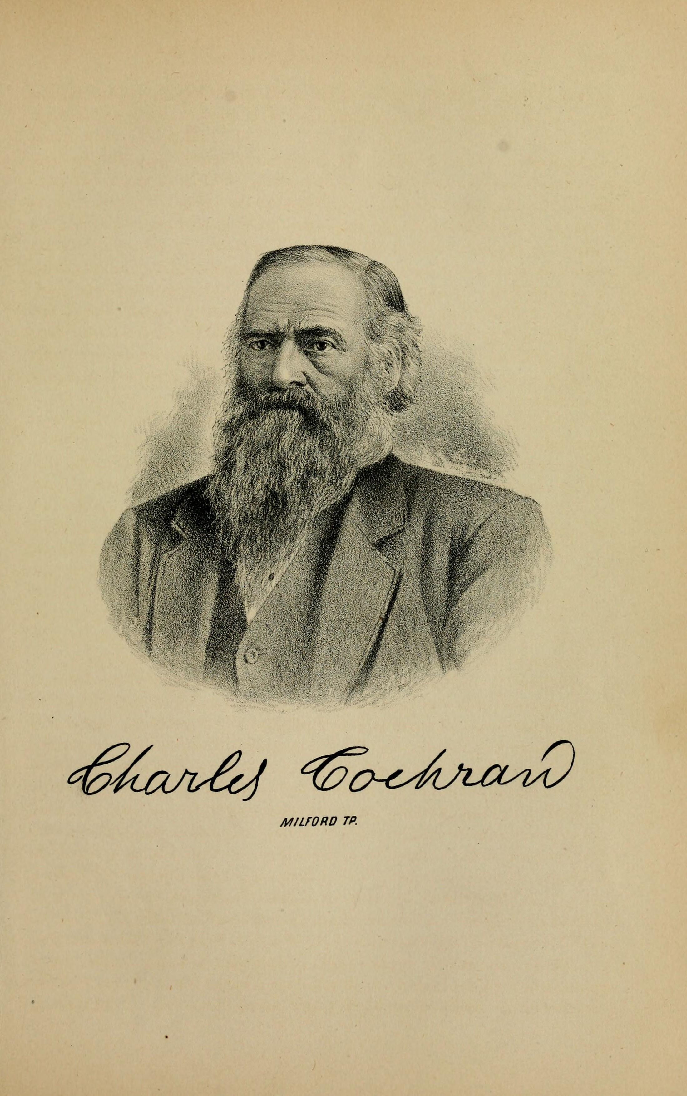
  • An 1882 lithograph bust portrait of an older man facing the viewer nearly square on. A high bald crown with hair left long at the sides and over the ears, heavy brows drawn together above deep-set eyes, and a full white beard falling well below the collar while the upper lip stays nearly bare. A dark coat with a wide lapel over a buttoned waistcoat and a white shirt with no visible tie. The figure fades into the paper below the shoulders with no border or frame. Beneath it an engraved signature in a flourished script reading Charles Cochran, and under that, in small spaced capitals, MILFORD TP.

    Milford Township

    An old horse, quite smart and active

    Charles Cochran was twenty-one and had less than four dollars when he walked out of this county in March of 1843, heading for Iowa. He came back thirteen months later on a horse he had traded for at Galena.

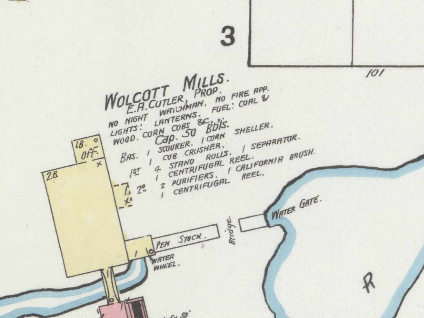
  • A detail from a colour fire insurance map. A yellow building stands at the left with a narrow wing running right to a structure lettered PEN STOCK and, below it, WATER WHEEL. A blue channel enters from the bottom left, passes under a bridge and widens across the lower right of the frame, with WATER GATE lettered where it meets the wing. Across the upper middle, in hand lettering rising slightly to the right, WOLCOTT MILLS., and beneath it in smaller letters E. A. CUTLER, PROP., followed by six lines of notes reading no night watchman, no fire app., lights lanterns, fuel coal and wood and corn cobs, capacity fifty barrels, and a list of machinery including a scourer, a corn sheller, four stand rolls, a cob crusher, a separator, two purifiers, centrifugal reels and a California brush. A large numeral 3 marks the block above.

    Wolcottville

    Seven occupations at once

    George Wolcott came to the southern line of Johnson Township in March of 1837, built a log house, and went back for his family in September. The race that fed his first mill, he dug himself.

All 9 pieces in Builders

Business

Where the money came from, who made it, and what it did to the towns.

  • Shipshewana

    A place to tell our story

    In 1970 a man in Shipshewana made a miniature horse-drawn wagon for his own enjoyment and it sold immediately. Sixteen years later, on the other side of the same street, a group of churches raised a barn because so many people were coming to town. Both of those are still there.

  • Shipshewana

    A price nobody would pay

    The first thing Mel Riegsecker built to sell, he did not want to sell. He asked his father to price it out of reach. His father sold it, somebody wanted another, and fifty-six years later the family runs eight businesses in a town of eight hundred and thirty-nine people.

  • Shipshewana

    The decade it turned

    Shipshewana gained thirty-eight people between 1920 and 1950 and lost some of them along the way. Then it gained a hundred and thirty-six in a single decade and has never gone backward since. Something happened in the sixties.

All 4 pieces in Business

Schools

What the county said it would teach, what it spent, and the rooms the children were actually in.

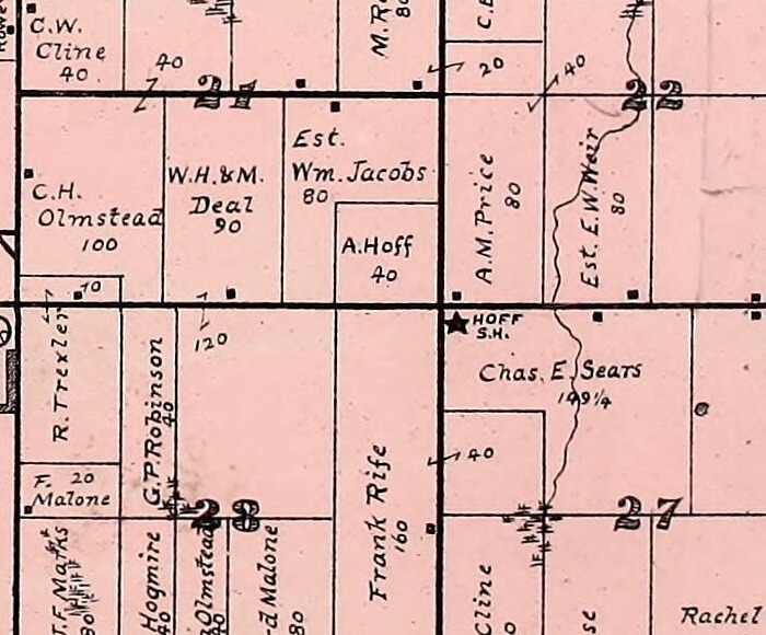
  • A detail from an 1893 county atlas plate, printed in black line on a pink wash. A solid black five pointed star stands at the inner corner of a numbered section, with the words HOFF S.H. lettered beside it in small capitals.

    Bloomfield Township

    The old schoolhouse is the back room

    A schoolhouse was drawn on a LaGrange County map in 1874 and left unnamed. In 1904 the township built two rooms and a hall in front of it and kept the old building as the back room, where it still stands.

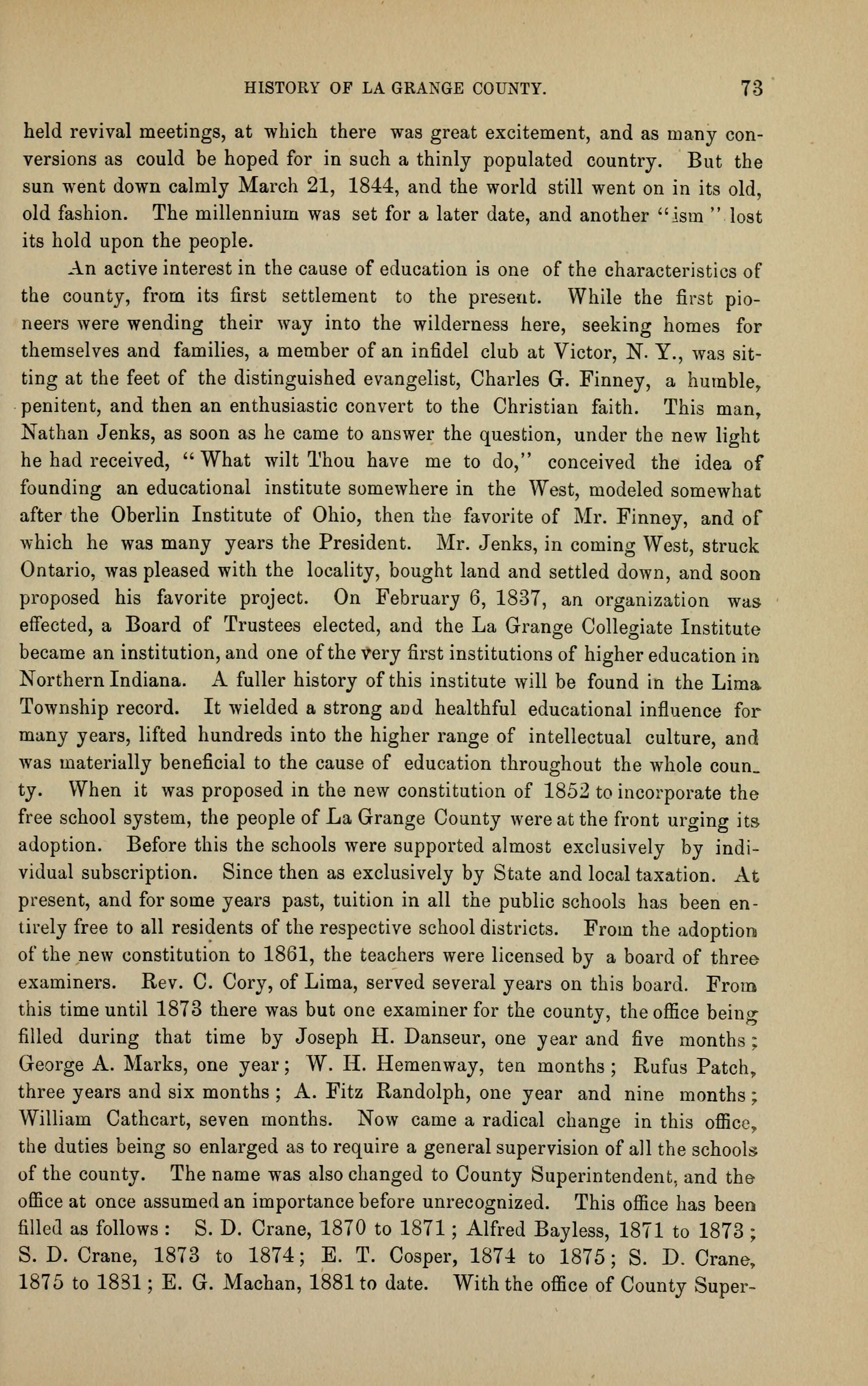
  • A printed page of an 1882 county history, a single column of set type on toned cream paper, numbered 73 at the top right beside the running head HISTORY OF LA GRANGE COUNTY. Three paragraphs of body type, the last of them running to the foot of the page and carrying a long series of personal names with dates against them. No illustration.

    Ontario

    The village with the college in it

    In the 1840s a district hired whoever would take the job, and paid them in corn. The fix was to gather teachers up and teach them how to teach. This county has been saying for a hundred and forty years that it went first, and nobody has ever been able to say who did it.

  • Eden Township

    A hole in the roof and the rest was the hearth

    The first schools in this county were log rooms with slabs for desks and no chimney. The teachers were paid ten dollars a month, or two bushels of corn a week, or ten shillings, and they lived in the houses of the families whose children they taught.

All 5 pieces in Schools

The maps

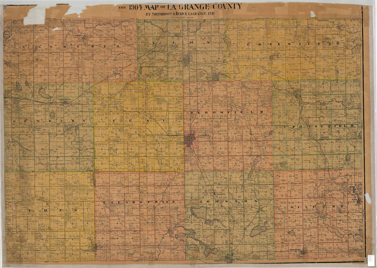
39 sheets of this county, drawn between 1852 and 1925. Two atlases with every landowner named township by township, four sheets from the Library of Congress, three lakes sounded to the foot, and this one, which two men in LaGrange drew and copyrighted in 1904.

Pick a township

A large printed county map of 1904, headed THE 1904 MAP OF LA GRANGE COUNTY BY SHEPARDSON & RERICK, LAGRANGE, IND. The eleven townships are washed in pink, yellow and buff and lettered in spaced capitals across their faces, each divided into numbered one mile sections with roads, streams, lakes and railway lines drawn across them and small black squares for buildings. The sheet is torn and patched along its top edge.

The 1904 Map of La Grange County by Shepardson and Rerick, lithographed by W. Wangersheim, Chicago. Map Collection, Indiana Division, Indiana State Library.

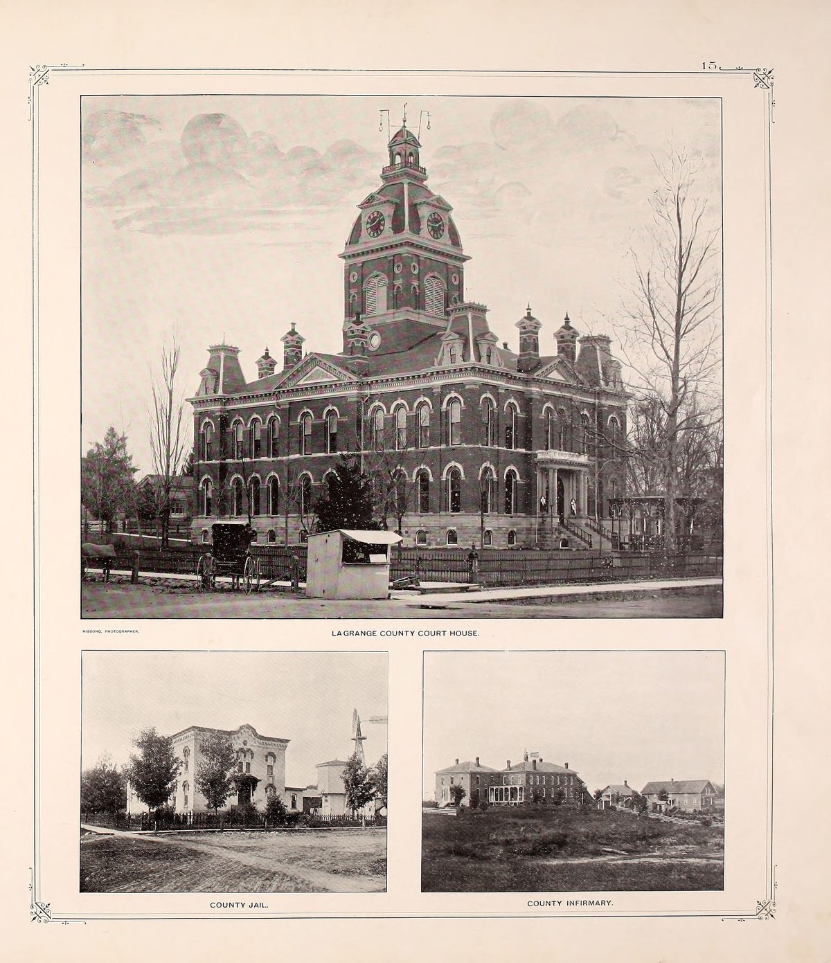
50 view and portrait plates from the two atlases and the 1882 county history, whole and uncropped, with every name on them taken from the books' own lists rather than read off the picture. The court house, the schools, the mills and most of the faces this county has.

Look at the plates

A printed plate from an 1893 county atlas, ruled with a double border and ornamented corners, numbered 15 at the top right. A large photograph fills the upper two thirds: a three storey brick court house with a clock tower and a domed cupola, arched windows on both floors, a covered porch at the right, bare trees and a picket fence in front of it, and a horse and buggy waiting at the kerb. It is captioned LAGRANGE COUNTY COURT HOUSE. Beneath it two smaller photographs, captioned COUNTY JAIL and COUNTY INFIRMARY, each a plain brick building among trees.

Illustrated Atlas and Columbian Souvenir of LaGrange County, Indiana, LaGrange Publishing Company, 1893, leaf 19. Public domain.

The county in 1874

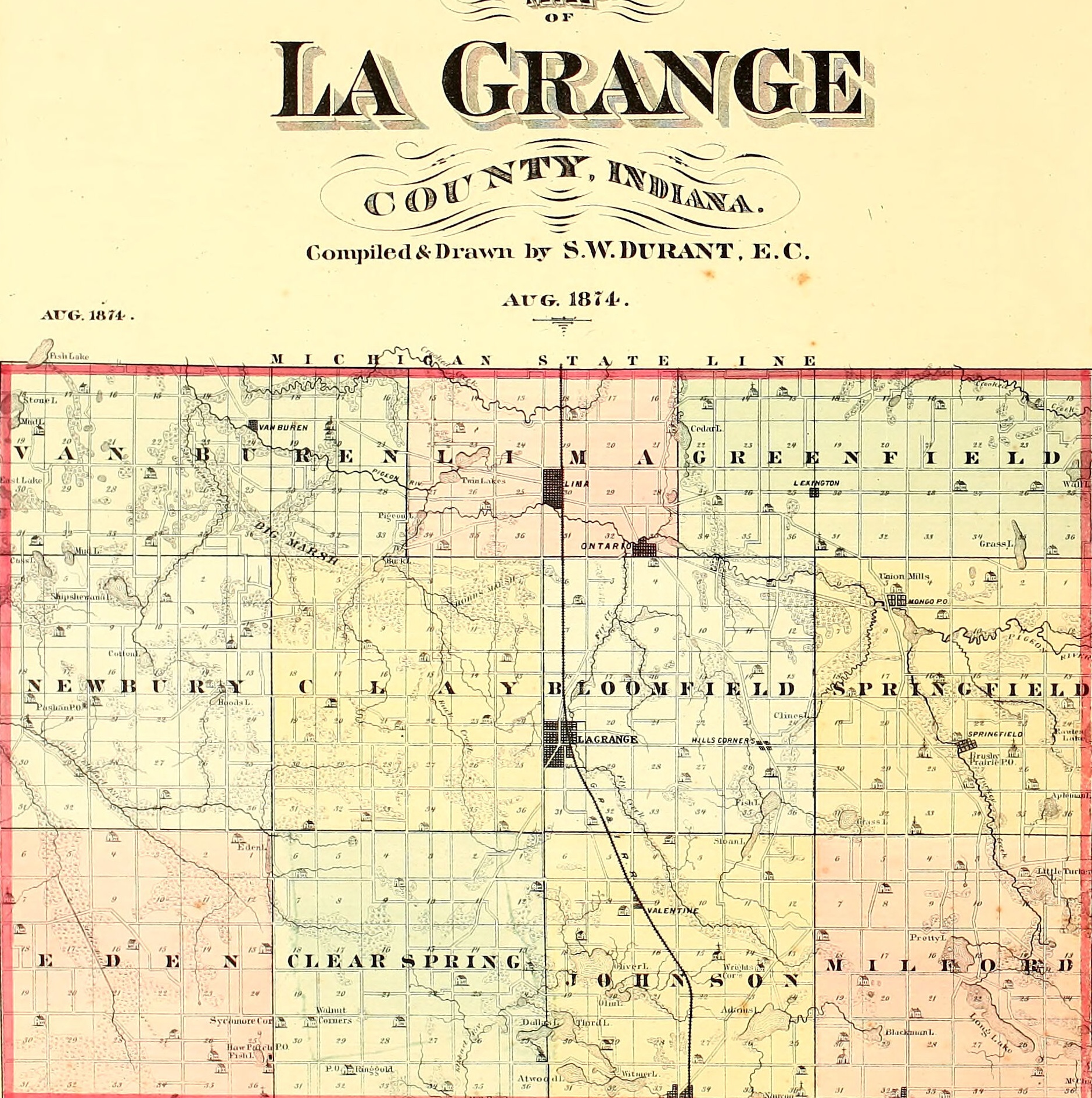
Samuel Durant drew this in August of 1874, four years after the first railroad reached LaGrange. Eleven townships, every section numbered, one railway running north to south. The county had been organised for forty-two years and had another nineteen before its own chronicles stopped.

The county in order

A hand tinted map of LaGrange County drawn in 1874, all eleven townships washed in separate colours on a grid of numbered one mile sections, with the Michigan state line along the top and a single railway running north to south through the middle of the county.

Map of La Grange County, Indiana, compiled and drawn by S. W. Durant, August 1874, from the Illustrated Historical Atlas of LaGrange County, Andreas and Baskin, Chicago. Leaf 16, printed page 12, via the Internet Archive.

The county

  • Lima Township, 4 pieces
  • Springfield Township, 3 pieces
  • Greenfield Township, 2 pieces
  • Bloomfield Township, 12 pieces
  • Van Buren Township, 2 pieces
  • Milford Township, 5 pieces
  • Clay Township, 1 piece
  • Johnson Township, 5 pieces
  • Newbury Township, 7 pieces
  • Eden Township, 2 pieces
  • Clearspring Township, 2 pieces

Eleven townships. The count is where a piece is chiefly set, so a town straddling two townships is counted once.

Support the Gazette

Nothing on this site is behind a paywall and nothing on it is sponsored. If it has been worth something to you, there are three ways to give something back, and only one of them involves money.

Support the Gazette